PREFACE contribution to Atlantic Observing System
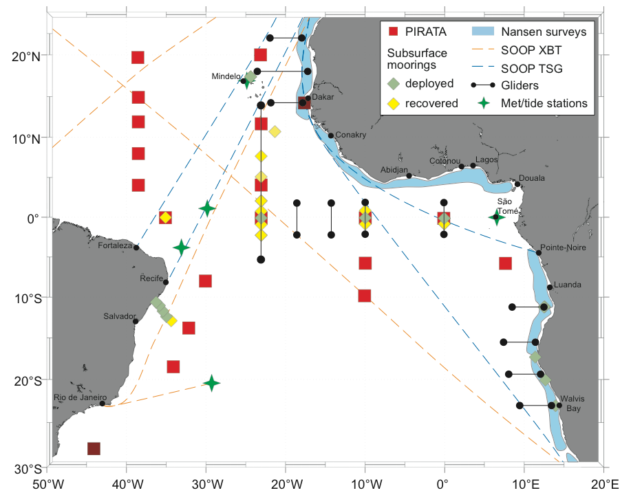
During the last decade much progress has been made in understanding tropical Atlantic variability. This was particularly due to the enhancement of the tropical Atlantic observing system within different international and national programs. The PREFACE project added observations in the eastern tropical Atlantic including near-coastal regions. Within PREFACE, new time series stations were established to enhance the PIRATA (Prediction and Research Moored Array in the Tropical Atlantic) network in the southeastern tropical Atlantic, to complement continuous measurements along the equatorial and coastal regions with subsurface moorings crucial for detecting climate signals propagating from the equatorial Atlantic towards the biologically productive eastern boundary upwelling regions, and to establish near-coastal atmospheric and oceanographic measurements off Senegal. Due to the intense cooperation and capacity strengthening activities within PREFACE, historical datasets from near-coastal regions off Africa, particularly including hydrographic data from the Nansen and EAF-Nansen programmes, could be made available for scientific analysis thereby drastically enhancing the climate record of the tropical Atlantic. Dedicated shipboard and glider observations carried out within PREFACE complemented the available database.
Observational data collected during the PREFACE lifetime is referred to in Milestones 4-10 and 12-16 under the responsibility of WP3&4.
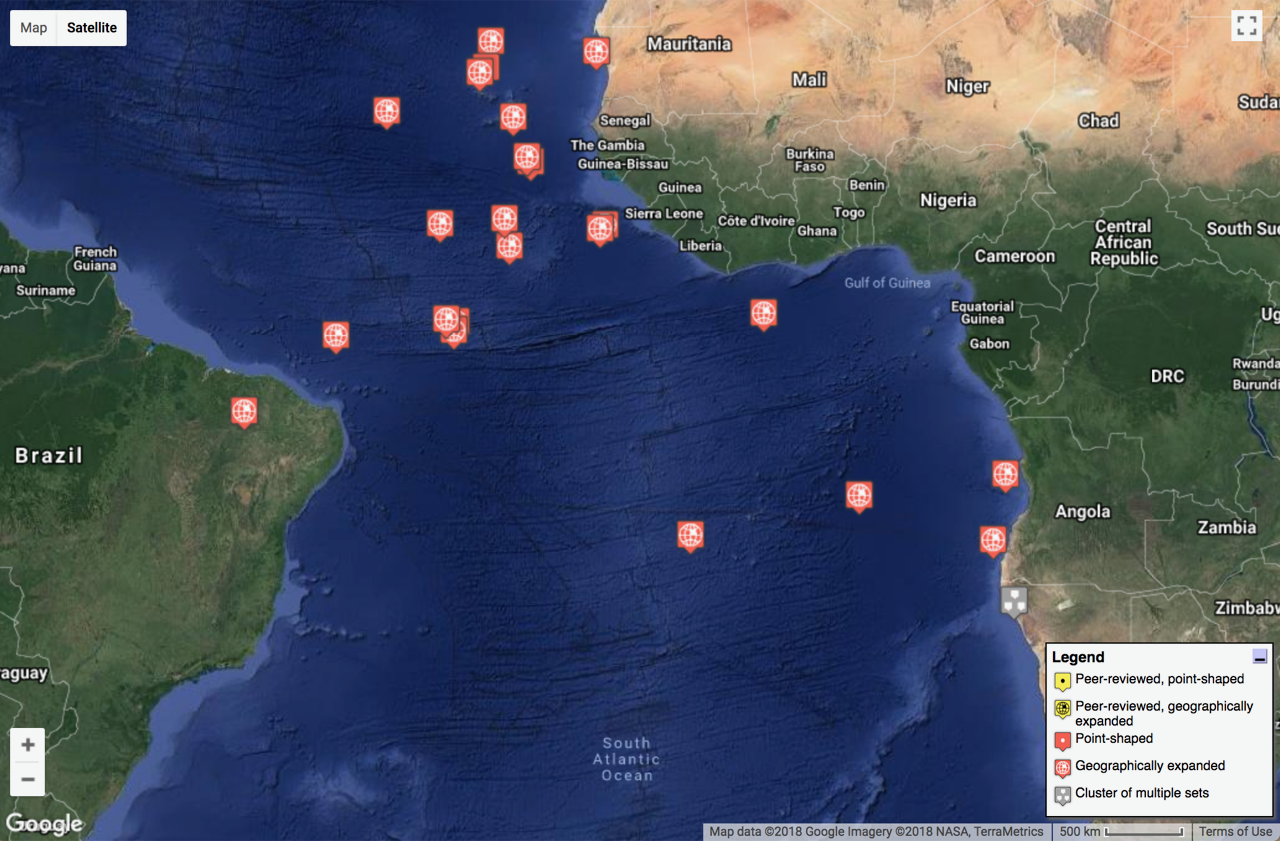
Data archived in PANGAEA
This data can be viewed in the interactive map below, including that of Milestone 12, not specified in the link above, that relates to the installation of a mooring on the shelf at 20S.
Data archived by PIRATA
PREFACE contributed two key elements to the PIRATA array: A PIRATA buoy – 8°E, 6°S – deployed Jun. 2013 and re-deployed May 2014; and subsurface equatorial current meter mooring at 0° (10°W deployed; 0°W re-deployed 2015); and made use of data from the entire PIRATA array available via external data archives. Observations from PIRATA are made publicly available through different web sites according to the data type:
- ATLAS meteo-oceanic buoys: http://www.pmel.noaa.gov/pirata/
- transmission and available in real time (24h averaged & transmission every 24h)
- validated data, a few months after yearly servicing (high frequency data)
- New T-FLEX meteo-oceanic buoys at 3 PIRATA sites (1h averaged & transmission every 6h): http://www.pmel.noaa.gov/pirata/tflex/
- Annual ship surveys data:
- French site: http://www.brest.ird.fr/pirata/ (All FR PIRATA surveys have a D.O.I. http://dx.doi.org/10.18142/14 and French S-ADCP data have a D.O.I. (2007-2018): http://doi.org/10.17882/44635
- USA site: http://www.aoml.noaa.gov/phod/pne/
- Brazilian site: http://pirata.ccst.inpe.br/en/home/
- Chemical data sets (nutrients, pigments); ftp://ftp.ifremer.fr/ifremer/ird/pirata/pirata-data/
Data collected by the MELAX buoy
The MELAX buoy was installed with the objective of quantifying ocean-atmosphere state , variability and coupling, in the Senegalese upwelling (mean seasonal cycle, variability, ocean mixed layer heat budget, air-sea interactions). For more information about this buoy: MELAX.
- Timeframe: from February 2015 to present.
- Location and depth: 14°20’N, 17°14’O ; 35 meter depth
- Data:
- Atmosphere : surface wind speed and direction, air temperature and humidity, solar radiation, downward longwave radiation, rainfall
- Ocean: surface salinity, current profile, temperature profile, bottom Salinity and Oxygen
- Archive: at LOCEAN-IPSL, available on demand.